 |
| Just past the Shut-Ins |
Just got back from a few days of backpacking with friends. Went down to Missouri and hiked the Taum Sauk Trail. We also visited Johnson's Shut-Ins State Park and finally Elephant Rock State Park.
The Taum Sauk Mountain State Park provides 7501 acres of solitude amid unspoiled land with a wilderness quality hard to find any where else. The park is located in the St. Francois Mountains, one of the most rugged and scenic areas in the state of Missouri. Almost 1.5 billion years ago, volcanic eruptions of hot ash settled and cooled to form rhyolite. Taum Sauk Mountain literally stands above others as the highest point in Missouri, rising to 1,772 feet. Mina Sauk Falls is the tallest wet-weather waterfall in Missouri, 132 feet over a series of rocky ledges. Taum Sauk is to believed to get its name from a Piankeshow Chief named Sauk-Ton-Qua.
 |
| We parked the car at the end point and now we are waiting for our pick up. We arrived about 20 minutes early. We won't see the car until Wednesday afternoon. |

 |
| Good thing I took a photo of this at the beginning, because when we arrived here at the end it was pouring rain. |
 |
| There were many of these small black butterflies on this flowering tree |
 |
| Mr. Franklin (can't remember his first name) shuttled us to the starting point. |
 |
| Started out with Mina Sauk Falls Trail |
 |
| It was paved just at first until the high point of Missouri |
 |
| Plaque marking the High point of Missouri |
 |
| Kevin actually got a little higher. I got my photo a few years ago. |
 |
| The trail turned to rocks. This was hard walking |
 |
| Saw many wildflowers on the trek. A form of Blue Phlox |
 |
| This is what the trail marker looked like. |
 |
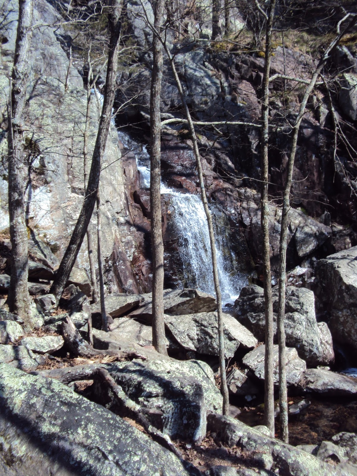
| Just arrived at the Mina Sauk Falls. Now we followed the trail down. |
 |
| We saw many waterfalls as part of the whole waterfall. Very impressive. |

 |
| Kevin watching his steps down to the bottom. |
 |
| Notice the falls in the distance. Yes that was the trail. |
 |
| Yellow bellwort was blooming in a few areas |
 |
| Devil's Toll Gate 8 foot wide and 30 feet high |
 |
| First camp site on Proffit Mountain. My tent is the green one in the middle. |
 |
| My set up |
 |
| In the background you can see the Taum Sauk Reservoir (more on this later) |
 |
| Ron with the Reservoir in the background |
 |
| The views were spectacular!!! |
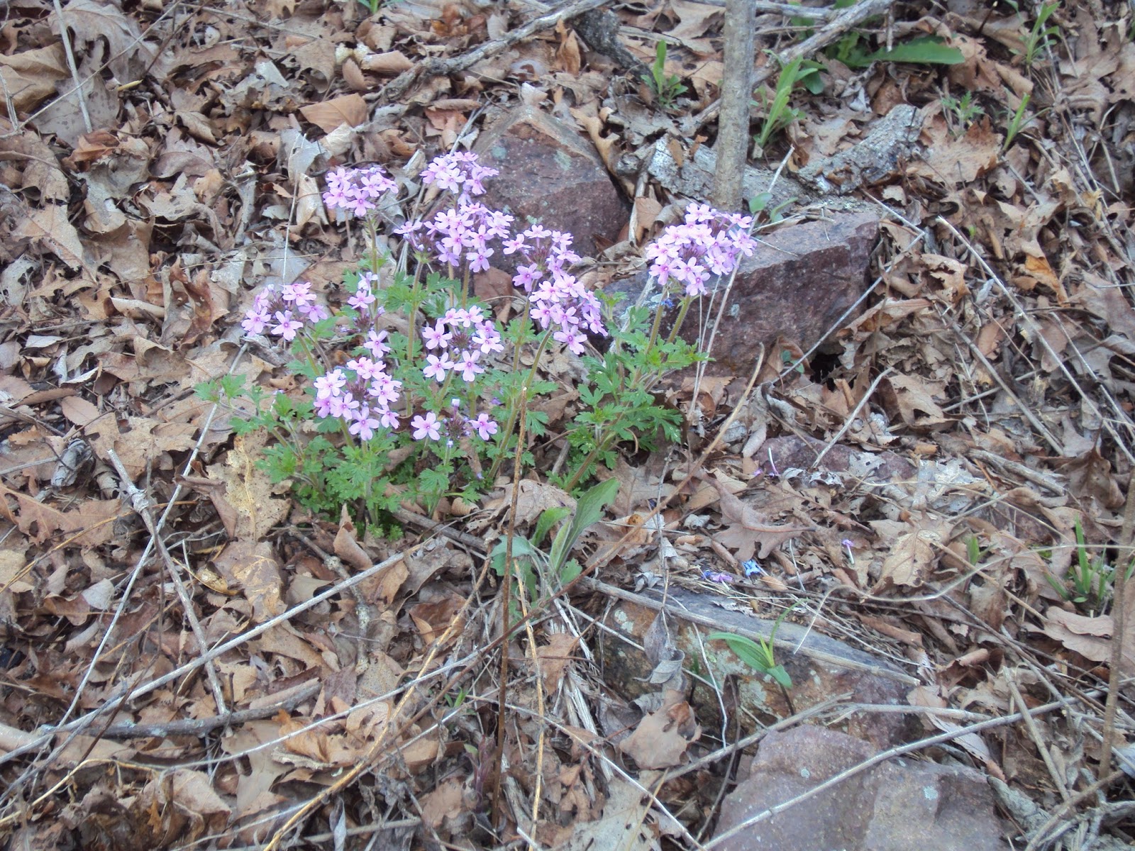 |
| We saw lots of this plant. I think it is in the Verbena family |
 |
| I really don't know what this is, but it colored up the landscape nicely. It looked like the helicopter seeds for a red maple tree. Just a guess. |
 |
| We were at an electric cut and had a great view of the Reservoir. |
 |
| They do have a problem with Wild Boars, so we think this is the purpose of the low electric fence |
 |
| The electric fence was solar. |
 |
| Lots of violets on the trail |
 |
| Most of the violets we saw were a beautiful soft lavender. This bunch had dark purple, lavender and white. Just stunning! |

 |
| Just trying to find the trail |
 |
| Following the Cairns, when they were there. Yes, we did lose our way a few times, sometimes as a group and sometimes all alone. |
 |
| I only found a few of these. Fire Pink Catchfly. First I have seen this one. Think I have it right. |
 |
| I have been watching for this sign every mile since mile 11. We won't visit here until our last day. Johnson's Shut-Ins State Park |

 |
| This was a little scary to read this sign. |
 |
| The scour |
 |
| The trail we were on crossed the Scour |
 |
| Kevin and Ron checking where the trail is through the Scour |
 |
| In the middle of the Scour is a small stream |
 |
| Looking back over the Scour from where we came. |
 |
| Prairie Trillium were small but blooming here. |
 |
| Blood root |
 |
| And then we came to the Black River. Here we had a "River Crossing" This meant the water was over our boots. I found a spot where the water was only knee deep. So we took our boots off and put our crocs on. I first walked my boots across and came back for my backpack. Once we all got across, we filtered enough water that would last us through breakfast the next day. Our proposed campsite was not going to have water. |
 |
| This site was a little of the trail. I by chance followed a cairn off the trail a ways and found this sight. Just big enough for 3 tents. |
 |
| This was our only sunset |
 |
| Sunset with a trail marker |
 |
| My tent set up |
 |
| Love my new hat and buff. Turned out to be a great combination |
 |
| Back on the trail |
 |
| We crossed a highway |
 |
| The trail continues |
 |
| Puff ball fungus |
 |
| Brittish Soldier Lichen. I have seen the light green lichen before, but never with the red ends. Looked it up and this is what I came up with. |
 |
| I found this Prickley Pear Cactus in two sections of the trail. Never really was fond of it, but my father in law sure liked it. |
 |
| What great views we had |


 |
| Just checking out the scenery. There were many scenic overlooks |
 |
| This was an exceptional trail with no rocks. Thank goodness! |
 |
| This was the Padfield Branch Stream, we camped here the third night |
 |
| This is what I used to filter my water. The Sawyer Squeeze. I would first fill up the aqua pouch and then screw on the filter (the smallest item in the photo) and squeeze the water out into the two containers. It went rather quick. A lot faster and a lot less work than the pump I had used previously. |
 |
| Camp set up |
 |
| This is my cooking set up. I would fill the small Nyquil container about 3/4 with denatured alcohol (in the orange container). The alcohol goes in the small round stove piece with the small round holes. I then add 2 cups of water to the pan. Light the alcohol and add the windscreen, pan and lid. Wait a few minutes for the boil and you are ready to add to your food or cup. You will remove the pan with the grabber, to pour the water where you want it. Windscreen, stove, and grabber fits in the clear container with blue lid. This set up is very lightweight and easy to use. |

 |
| Found this little birds nest close to the trail |
 |
| This sign was a bit confusing. But with Ron as our guide we had no trouble. |
 |
| These were just so colorful, I couldn't resist a photo. |
 |
| This metal tag on this tree is a geological marker to help arborist keep track of certain trees. This tag did have a number on it but it just didn't come out in the photo |
 |
| This marker was at the top of Bell Mountain. We were going to stay here, but it started to rain pretty good, with no sign up letting up any time soon, so we thought we would go check out the overlooks and just walk the 3 miles to the car and stay in a motel the last night. |
 |
| View from atop Bell Mountain |
 |
| View from Bell Mountain |
 |
| View from Bell Mountain |
 |
| Once we checked into the hotel, we went to the laundromat. I was lucky I had dry shoes in the car. I always said I love color. These are my yellow and peach camp slipper/socks. I have been backpacking with them for 5 years. |
 |
| We also went to dinner. I had a Turkey Rueben with chips and off course this Big as your head Cinnamon Roll. Cream cheese frosting of course. And a tall glass of ice cold water -2 |
 |
| We were the only ones there |
 |
| The layout of the park. We followed the Braille Trail |
 |
| This was at the entrance to the park |


 |
| The engine house |
 |
| The lines are where they would put the plugs to separate the pieces of granite to more manageable pieces |
 |
| This series of rocks is suppose to depict a herd of elephants |

 |
| This was soooooo heavy! |

 |
| When the workers were mining here, once they become master stone cutters they would carve their names in the stone. |


 |
| Fat man squeeze. Ron and Kevin had no trouble |
 |
| The quarry |
 |
| |


 |
| The shut ins |
 |
| The water was so powerful, I just had to take a video. |
 |
| On the weekends this area is just packed full of people wading, swimming, and just having a great time. |


 |
| Past the Shut -Ins the water is an Aqua Blue. The water then continues downstream becoming the Black River. |
I will leave you with this: Happiness is taking your boots off after a long hike.
No comments:
Post a Comment